Lake Rover
Locating Invasive Aquatic Plants Early to Avoid Infestation

Concepts
Get ahead of the spread of invasive plants by…
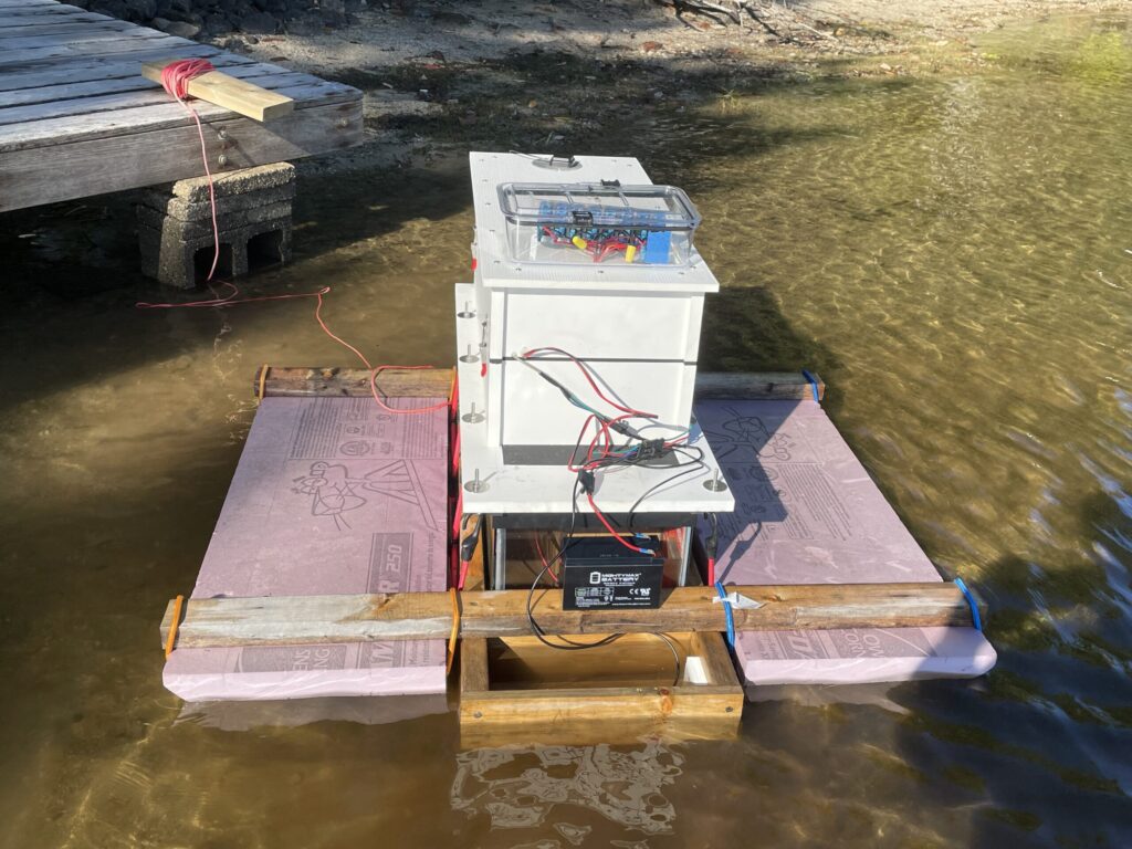
Developing Hardware
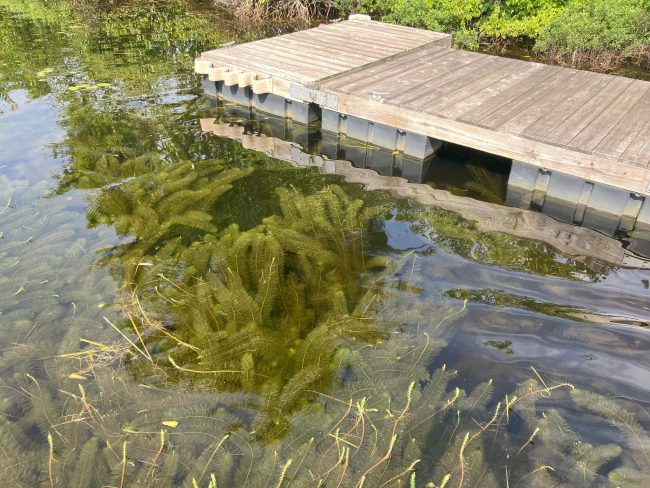
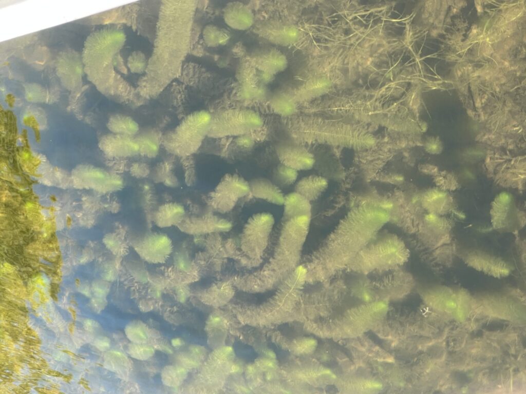
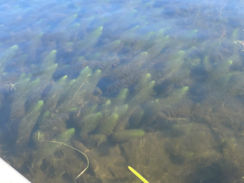
Low-cost, autonomous lake surface vessels with underwater cameras to record images of plants and their GPS location – creating surveys.

Lengthening The Season
Increasing the hours / year spent surveying
12 hours / day,
7 days / week,
April through October.

Developing Software
Machine learning based image classifiers to automate the analysis of recorded images.
Milfoil Teams’ Focus
Allowing Milfoil Teams to spend all their effort removing invasive plants because they no longer need to perform surveys.
The 24 Hour Cycle
What happens each day
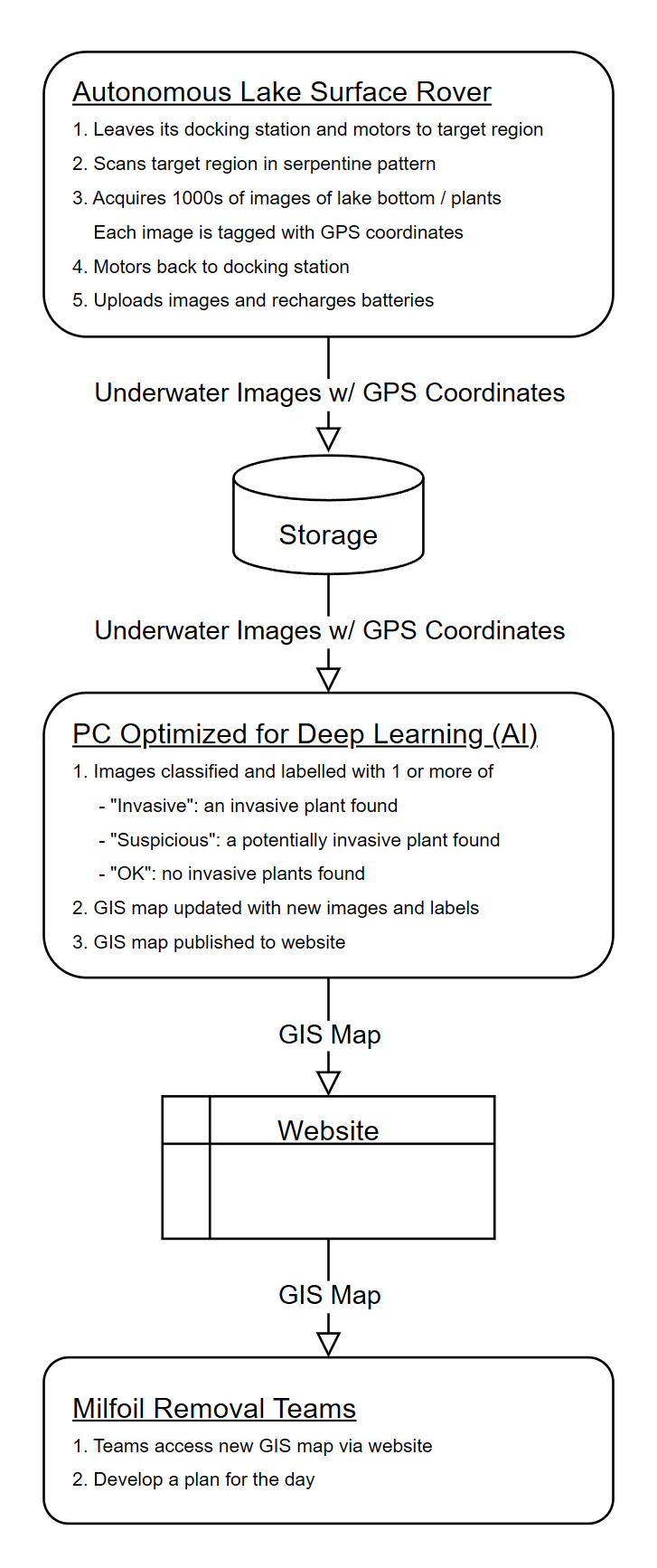
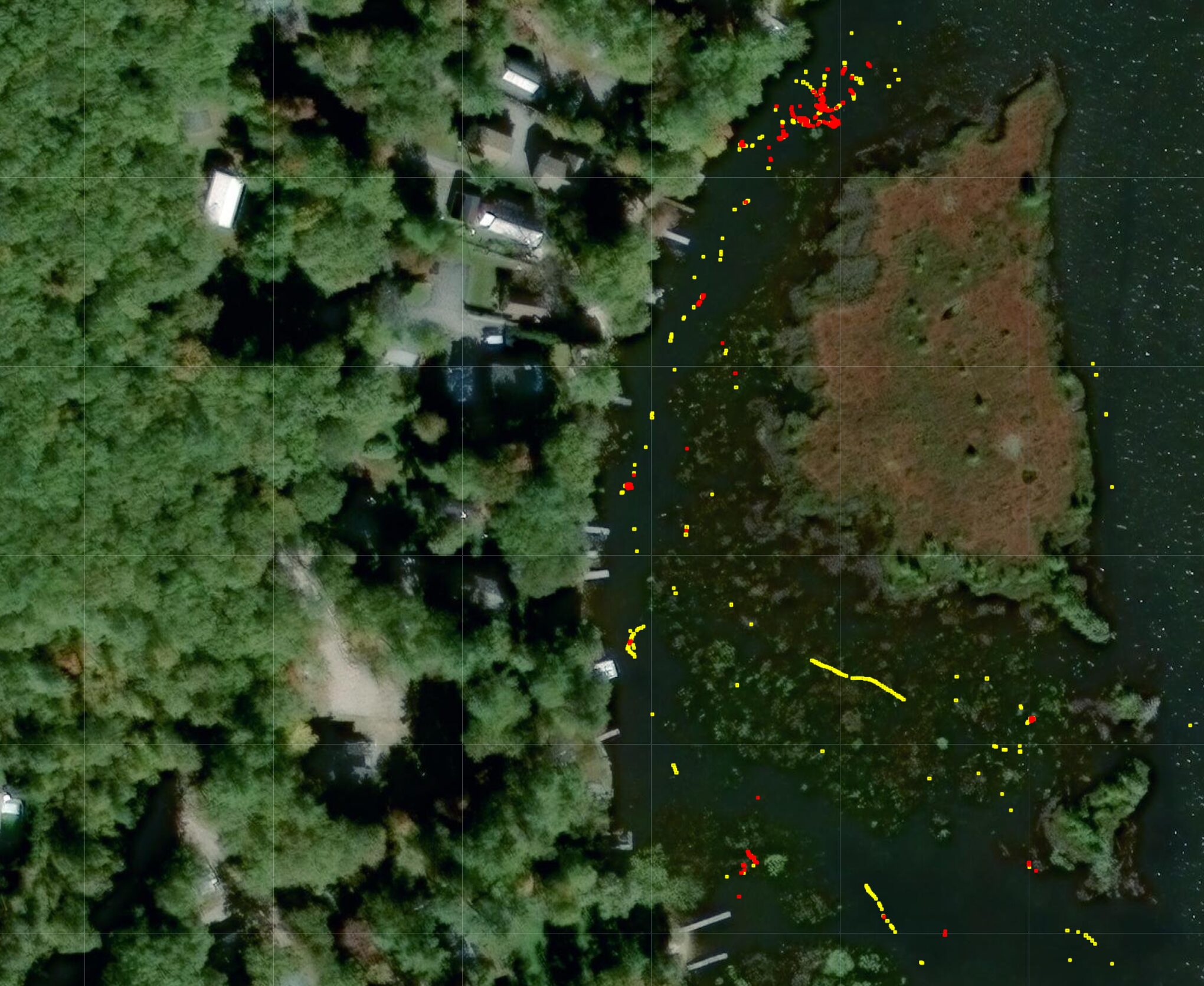
Interactive GIS Maps
Lake Rover provides an updated GIS map every night. The updates are based on the prior day’s images and the analysis of those images. Armed with an up to date GIS map, milfoil teams can decide where to apply their efforts.